Popular Outdoors & Open Spaces

Outdoors & Open Spaces
Cambridge is famous for its open spaces, aside from the many college lawns and gardens, which help to make it a very attractive and healthy place to live. Cows are a common sight in summer on areas of ‘common’ land even quite close to the centre, as local farmers still take up the city’s historic grazing rights.
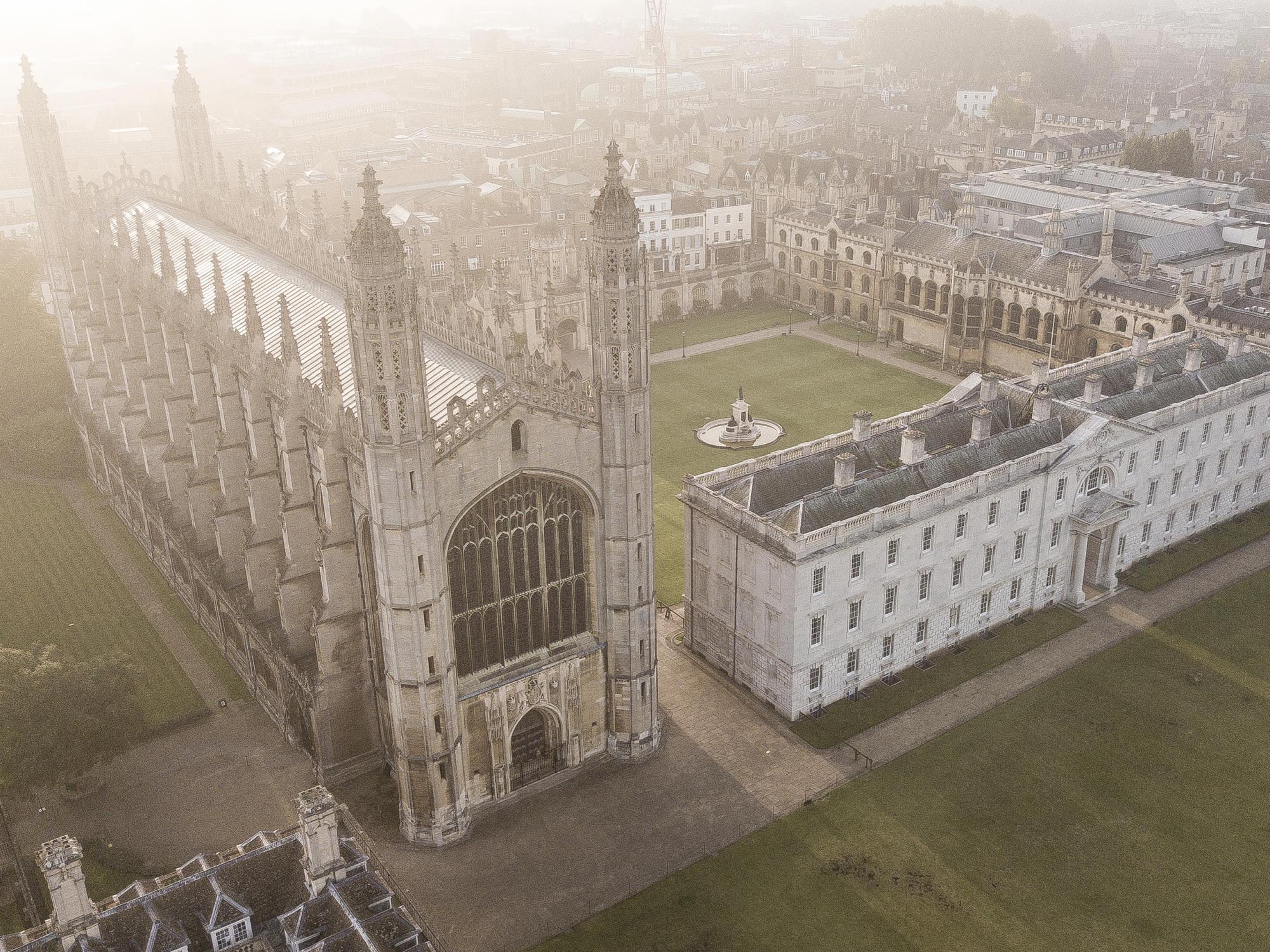
The Backs: Literally the backs of the six colleges along the river, a mixture of pristine lawns, pastureland and gardens, east of Queens Road, sometimes rated as one of the top scenic places in the country. The view across to King’s Chapel is the most iconic image of Cambridge University, though the building on the left is in fact Clare College, not King’s itself.
Coe Fen: Walking on to the Anchor and Mill pubs, you reach a thriving hub of activity, where many punt trips start, as well as the beautiful trail along the Cam to Grantchester. Cows and sheep graze in the Coe Fen nature reserve, which includes swans in the Mill Pond, and extends across Fen Causeway to Sheep’s Green, and Lammas Land, which has one of the best children’s parks in the city, complete with paddling pool in the summer. At the south end, just beyond the bridge is a small garden with Hodson’s Folly, put up in 1887 to allow John Hodson to keep watch on his children as they played in the river. This stretch of the river is also where you might see students ‘bridge-hopping’ as they punt along, hoping to jump back into their boats after clambering over each bridge!
Parker’s Piece: A grassy recreational area in the centre of town (though for many of the less-fit students ‘a long way away’), Parker’s Piece was named in 1613 after the Trinity College cook, Edward Parker, who leased it for farming. It is a long-favoured spot for games of cricket (for much of the 19th century it was a first-class cricket ground) and football (there is a monument marking its influence in establishing the rules of football), and in the last decade it has seen the Olympic Torch pass through and the start of the third leg of the Tour de France. However, its grandest day was 28 June 1838, when 15,000 of the town’s poorer people were treated to a feast to celebrate Queen Victoria’s coronation. Some sixty tables radiated out like spokes of a wheel from the central area, where there was an orchestra and choirs, as well as space for the many paying spectators. Today at the Piece’s centre stands the large iron lamppost Reality Checkpoint, whose origin is obscure but may refer to students leaving the university bubble to come into the real world. Spot the dinky door here – one of eight hidden around Cambridge as a modern art addition to the city.
Castle Hill: On the north side of town is its highest point, and finest viewpoint. Today only earthworks remain of the various castles constructed here, starting with the Romans who wanted to keep an eye on the Iceni tribe following Boudicca’s revolt. They built a long wooden bridge from the foot of Castle Hill as a strategic crossing of the Cam (which would have been over 100m wide, a far cry from the current canalized river). The bridge was also part of the Via Devana, or road to Deva (the Roman name for Chester), which started in Colchester. Being largely for military purposes this route largely fell out of use after the Romans left, and its route is now hard to follow, but it did run through Duroliponte (Cambridge). Castle Hill was also important in Norman times and during the Civil War (with clear earthworks visible from this time), and is really the nucleus of Cambridge’s Old Town. Coming right up to date, though no longer outdoors, in the 1980s an underground nuclear bunker was built here, now occasionally open to the public.
The Cam running north: Heading along the river you come first to Jesus Green, with its outdoor swimming pool and lock, and then Midsummer Common, where the river is lined by houseboats, and many of the college boathouses are located. Practice and races take place from here all the way down past Stourbridge Common to Baits Bite Lock. Stourbridge Fair was a famed annual event which was granted a formal licence by King John in 1211 and ran for over 700 years, originally to support the Leper Hospital (the Leper Chapel is still standing on Newmarket Road and is one of the oldest complete buildings in Cambridge). The fair became one of the largest in Europe, described by Daniel Defoe as the greatest in the world. It has been revived in the 21st century as a medieval re-enactment each September.
Coldham’s Common: East of the centre, this extensive common is a thriving nature reserve as well as favourite area for sport and relaxation: it includes the Cambridge United football ground, swimming pool, sports ground, BMX park, playground and summer splashpad. A recent addition is the weekend park runs (5km on Saturday and 2km on Sunday). It was once the site of an isolation hospital for those suffering with small pox, later a mining centre for coprolites (fossilized dung), before being turned into a rifle range in the 19th century. It is now one of the largest open spaces in Cambridge.
Botanical Gardens: First opened in 1762 in the New Museums Site in the centre of town, the Botanical Gardens were moved out to a larger site between Hills Road and Trumpington Street by Henslow (tutor of Darwin) in the mid-19th century. It holds some 8,000 species, and is very much focused on teaching and research, although it is very much liked by wealthier locals, who appreciate the gardens as well as the decent café.
Hobson’s Brook: Dating back nearly 400 years, this brook runs from Nine Wells Nature Reserve (south of town, past the Addenbrooke’s site) to the centre of town, splitting into Vicar’s Brook and Hobson’s Conduit, an artificial passage. En route it creates a peaceful channel (and popular path) past allotments south of Brooklands Avenue and then runs alongside the Botanical Gardens. Hobson’s Conduit then continues up Trumpington Street to the centre of town, passing the Market Fountain (previously in the Market Square, now on Lensfield Road). This is a monument to Thomas Hobson, a Cambridge-to-London carrier who would insist on only giving out the freshest horses to his customers, so that they had no choice which horse they got – a modus operandi that has lived on in the phrase ‘Hobson’s choice’.
Cherry Hinton Chalk Pits: Some way out to the southeast, this little-known gem is an unusual disused chalk quarry with Roman and iron age remains, rife with wild flowers and butterflies. Beside it is a woodland nature reserve, and there are more trees and parkland to explore around Cherry Hinton Hall nearby, with another great playground for children.
Cemeteries: Mill Road Cemetery is the most loved of many cemeteries in the city, used as a cut through from Mill Road heading north, and a vital source of local history, wildlife and blackberries. Many of the renowned local businessmen of the 20th century were buried here or in Histon Road Cemetery, but the city’s most distinguished residents were buried in Ascension Parish Burial Ground, including the philosopher Wittgenstein, John Cockcroft (who split the atom), Frederick Hopkins (who discovered vitamins) and John Adams (who discovered Neptune). There is also a large American War Cemetery at Madingley a few miles west of town, reflecting the importance of this region for US air bases during the Second World War.
– Christopher Jagger ‘King’s College, Alumni’
